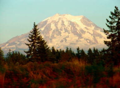
Mount Rainier, highest (4,392 meters – 14,410 feet) and third-most voluminous volcano in the Cascades after Mounts Shasta (in California) and Adams, dominates the Seattle-Tacoma area, where more than 2 million know it fondly as The Mountain. The Mountain is, however, the most dangerous volcano in the range, owing to the large population and to the huge area and volume (92,000,000 cubic meters and 440,000,000 cubic meters, respectively of ice and snow on its flanks that could theoretically melt to generate debris flows during cataclysmic eruptions. In addition, sector collapses of clay-rich, hydrothermally altered debris have generated at least three huge (>2×10⁸ cubic meters) debris flows in the last 5,000 years.
Mount Rainier
Location: Washington
Latitude: 46.87 N
Longitude: 121.758 W
Height: 4,392 Meters (14,410 Feet)
Type: Stratovolcano
Latest Eruptions: About 1820(?); 1841-1843(?); 1854(?); 1879; 1882 3.
Present thermal activity: Occasional steam explosions on upper slopes; many steam vents and hot rocks in summit area.
Remarks: History of massive debris avalanches and debris flows. Occasional very shallow seismicity. … Largest of the Cascade volcanoes. A mudflow caused by steam explosions about 5,700 years ago was one of the largest known in the world. Expected to erupt again within the next hundred years; hazards consist mainly of mudflows, floods, and fallout of tephra
Seismic Activity: Steady, increasing
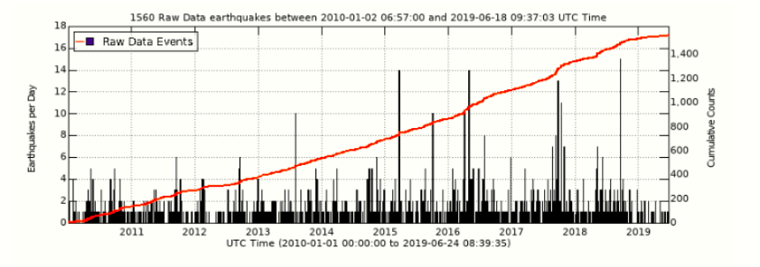
I came back in 2019 (when I ported the page to the new website), and checked out the activity… things seem to ahve gotten busier…
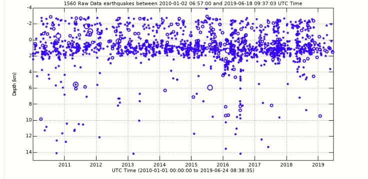
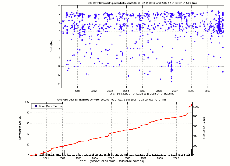
Here is a seismicity plot that shows the number of located earthquakes per day (black spikes) and the cumulative number of earthquakes over time (red). This can point out periods when more earthquakes were located such as a few days period in the spring of 2015 and summer of 2016 as oppossed to the very quiet period during spring and summer of 2012.
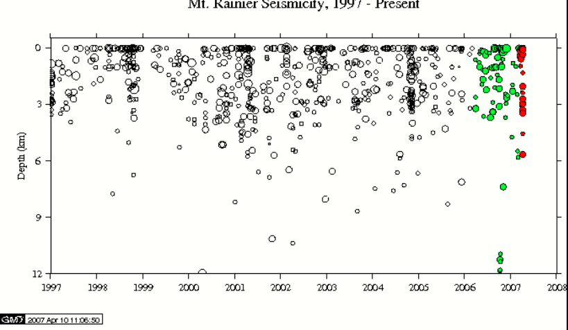
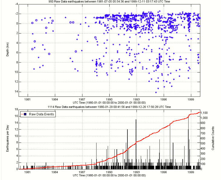
Looking at the period 1991 to 2000, you can clearly see the increase…
Here’s the look through 2001 – 2010…