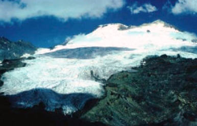
Mount Baker (3,285 meters; 10,778 feet) is an ice-clad volcano in the North Cascades of Washington State about 50 kilometers (31 miles) due east of the city of Bellingham. After Mount Rainier, it is the most heavily glaciated of the Cascade volcanoes: the volume of snow and ice on Mount Baker (about 1.8 cubic kilometers; 0.43 cubic miles) is greater than that of all the other Cascades volcanoes (except Rainier) combined. Isolated ridges of lava and hydrothermally altered rock, especially in the area of Sherman Crater, are exposed between glaciers on the upper flanks of the volcano: the lower flanks are steep and heavily vegetated. The volcano rests on a foundation of non-volcanic rocks in a region that is largely non-volcanic in origin.
Mount Baker Volcano
Location: Washington State
Latitude: 48.786 N
Longitude: 121.82 W
Height: 3,285 Meters (10,778 Feet)
Type: Stratovolcano
Latest Eruptions: 1820(?); 1843; 1846; 1853-54; 1858; 1859-60; 1863; 1870 3
Note that the 1820 eruption is an estimate based on local native populations relaying the history of the mountain’s activity prior to European population’s arrival.
Present thermal activity: Steaming fumaroles at flank and crater locations.
Remarks: Increased heat output and minor melting of summit glacier in 1975; some debris flows not related to eruption. History of extensive pyroclastic flows… Heat emission increased markedly in crater area in 1975 and produced warm, acidic meltwater and effusive emissions of steam containing occasional traces of ash and sulfur dust. Activity had diminished somewhat by 1978.
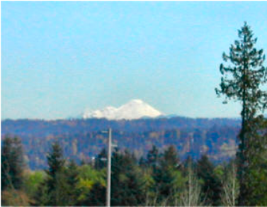
I took this picture of Mt Baker from the parking lot of where I worked; at Safeco Life, in Redmond.
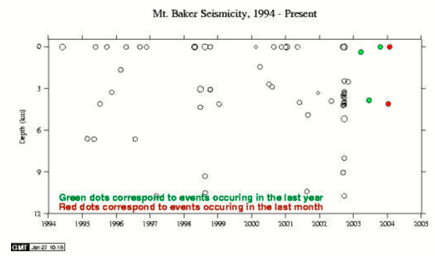
Seismic Activity: Not very active, but “warming up.”
the 10 years prior to 2004:
Historical Activity
Historical activity at Mount Baker includes several explosions during the mid-19th century, which were witnessed from the Bellingham area, and since the late 1950s, numerous small- volume debris avalanches. In 1975, increased fumarolic activity in the Sherman Crater area caused concern that an eruption might be imminent. Additional monitoring equipment was installed and several geophysical surveys were conducted to try to detect the movement of magma. The level of Baker Lake was lowered and people were restricted from the area due to concerns that an eruption- induced debris avalanche or debris flow might enter Baker Lake and displace enough water to either cause a wave to overtop the Upper Baker Dam or cause complete failure of the dam. However, few anomalies other than the increased heat flow were recorded during the geophysical surveys nor were any other precursory activities observed to indicate that magma was moving up into the volcano. An increased level of fumarolic activity has continued at Mount Baker from 1975 to the present, but there are no other changes that suggest that magma movement is involved.
