On the Luckiest day of the century, the 7th year, the 7th month, the 7th day, we went to show off Washington’s most famous Mountain, Mt St Helens, to my cousin, who was visiting from Florida.
It had been almost a year since I’ve been there… the longest stretch since I moved back up this way in 1999… the changes were quite striking, actually.
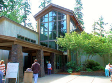
We decided to not start out at “O-dark-30”, which is when I usually go, most of the time to catch the sunrise, and set a plan to only stop at a few of the welcome centers along the way… stopping at them all is a bit tedious…:-)
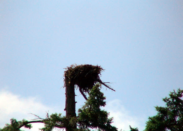
At the first Welcome Center, an Osprey family has set up shop above the building in an old snag.
The top of the tree broke off in a wind storm, providing the perfect anchor for their nest.
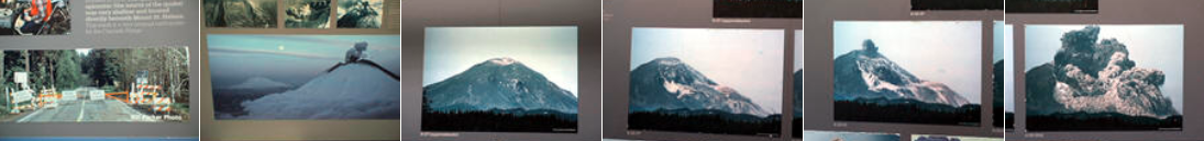
Inside the welcome center, you’re greeted by a grand hall, and a picture of the exploding mountain. A movie tells you about the process behind the explosion that changed the Toutle Valley forever.
3-D maps show where everything is, and there’s a wall of pictures showing images and news events leading up to the fateful day in May.
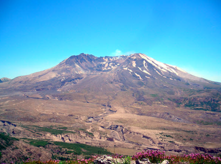
Mt St Helens, and Spirit Lake, was quite beautiful… All that changed one Sunday morning, when an earthquake broke whatever was holding the North Face in place, letting it fall in the largest landslide ever witnessed by man.
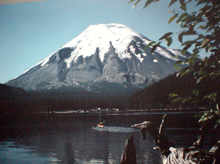
The magma underneath, suddenly released from all the weight holding it back, exploded outwards, devastating everything in its path for miles.
In only a few minutes, the landscape that was so picturesque was forever altered.
Its amazing. I’ve been there many times, and have looked over those pictures almost as many times, and it still gets me.
We left the Welcome Center, and proceeded up the state highway – stopping, of course, at the Weyerhaeuser truck, and the KOMO news car, and the logging camp restaurant.
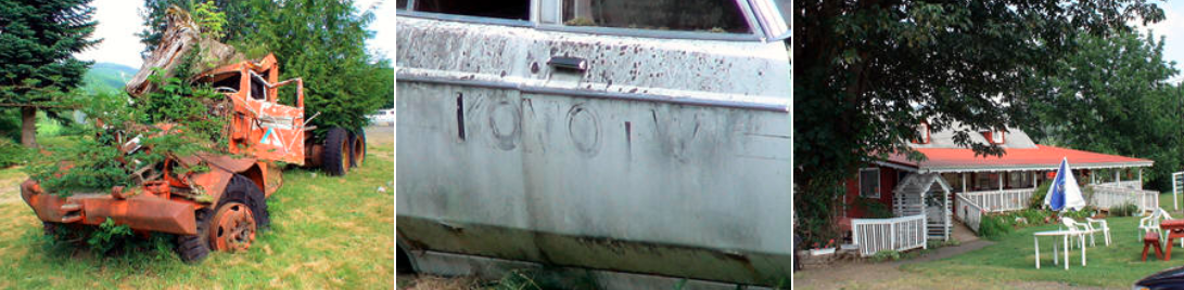
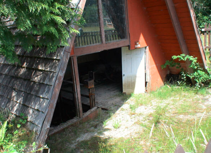
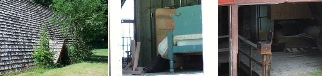
We stopped at the “A” frame house, too.
This family was 3 days away from moving in. They were away visiting friends for a couple of days before moving into their new house near the Toutle River.
When The Mountain blew, a wall of mud and debris rolled down the valley, and their home became encased in a concrete mud mixture. A large tree bashed in the front of the house.
Rather than fix it, the family decided to purchase a house next door to their property, open a store, and make the best of it. They never lost the love for the Mountain.
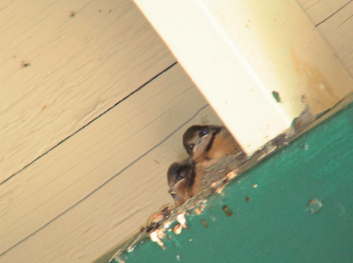
Above the door of a gift shop at the “A” frame house, a little swallow family peeps at you as you enter or leave…
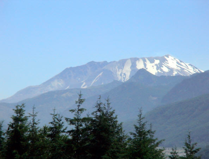
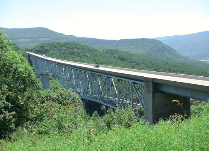
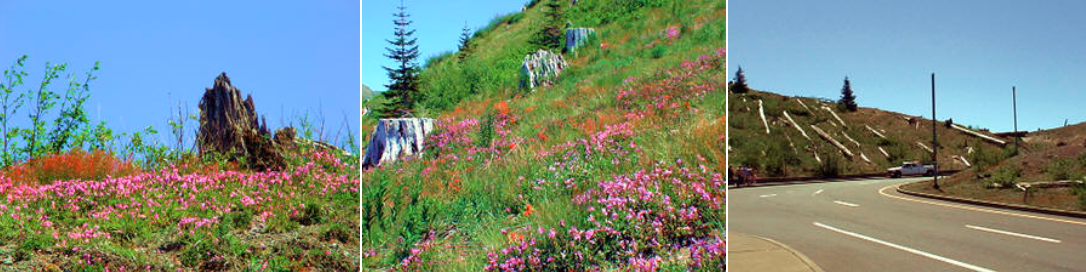
At the Hoffstadt Bluff overlook, you’re treated to an awesome view!
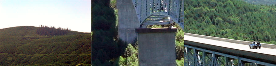
The Hoffstadt Creek Bridge, about a half mile long, is an impressive sight. The west end of the bridge sits on the edge of the “Blast Zone”… the line around the mountain where the trees were knocked over or killed by the searing heat.
All of the trees closer to the Mountain than this point were either planted by Weyerhaeuser (it is their farm, after all), or grew there naturally.
Pockets of trees, behind ridges and outcrops of rock, were spared, but everything – even the bacteria in the ground – around those oasis’s was laid waste.
The bridge is pretty impressive on its own, I think anyway.
Coming up the valley from the bridge, another incredible view awaits you.
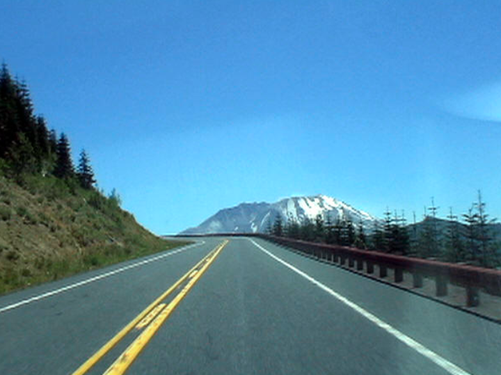
As you get closer to The Mountain, the views get more grandiose.
I’m always amazed at how much closer the “green” seems to be to the Mountain’s flanks… the recovery has been quite remarkable.
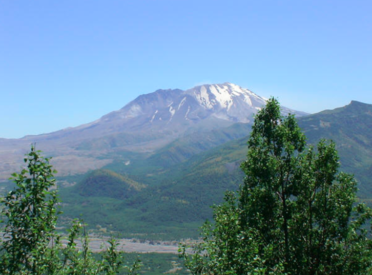
The regrowth is pretty impressive. You can still see the destruction behind it all, but it really is coming back.
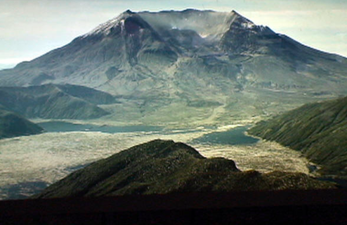
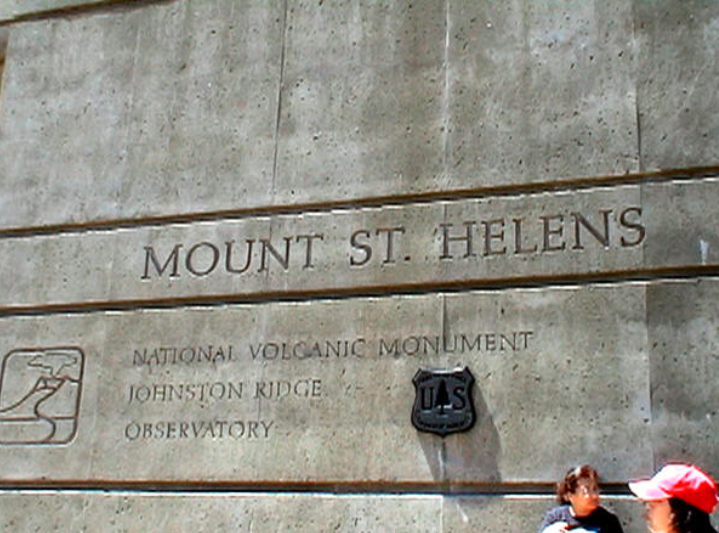
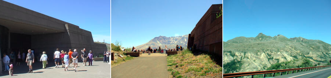
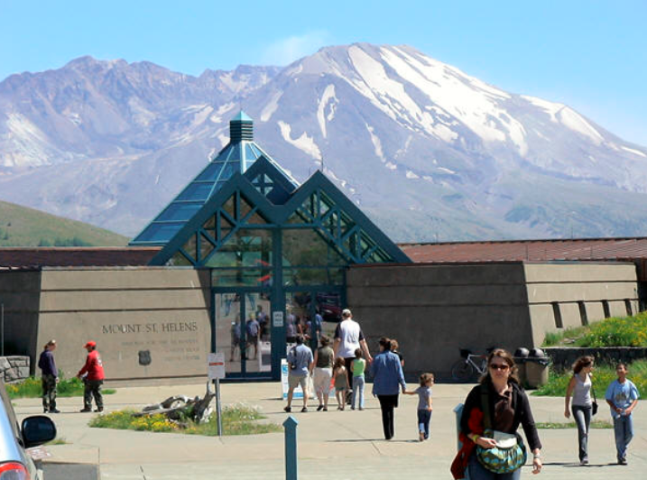
Before too long, we were at the Johnston Ridge Observatory, set up across the valley from the Mountain, on a ridge where David Johnston made his famous radio call, “Vancouver! Vancouver! This is it!”
The area around the Observatory has changed a lot over the years… more flowers, more variety of plants, MUCH more green! You can still see the damage, but the changes are quite amazing to see!
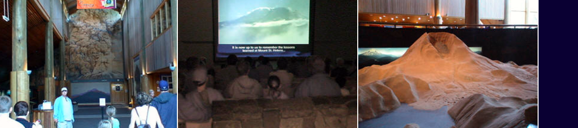
Displays inside the Observatory show the extent of the area damaged by the blast… its quite incredible.
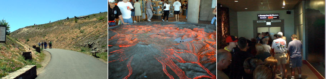
A film clues you in on what you’re looking at, and the process behind the geologic features you’re able to pick out on the slopes and in the Crater.
It ends with a dramatic raising of the curtain… on a clear day like today, its pretty striking!
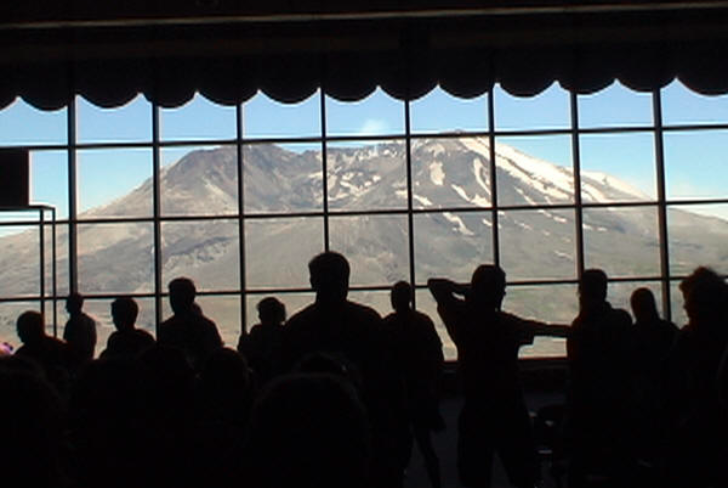
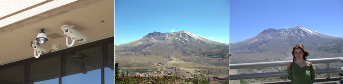
We went outside, and checked out the valley and the Mountain, and of course took the “I was there” photos… 🙂
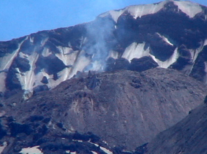
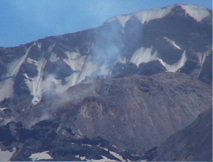
they have a couple of new cameras set up to observe the happenings during the current dome building eruption that’s going on…
Steam rises out of the new dome. The newly exposed hot rock reacts with the cold mountain air.
I really like my video camera’s zoom… and the pictures it takes aren’t too bad, either. It has a bit of trouble with the white balance, and really bright scenes come out looking sort of dark, but I can’t complain – the zoom MORE than makes up for it!
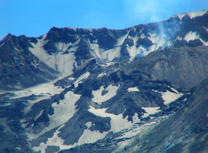
The new spine, called “Spine #7” by the CVO, is extruded from the lava shaft at a rate of about a dump truck’s worth of rock every 20 seconds.
The glaciers, squished out of the way by the growing dome, have accelerated their slide down the floor of the crater
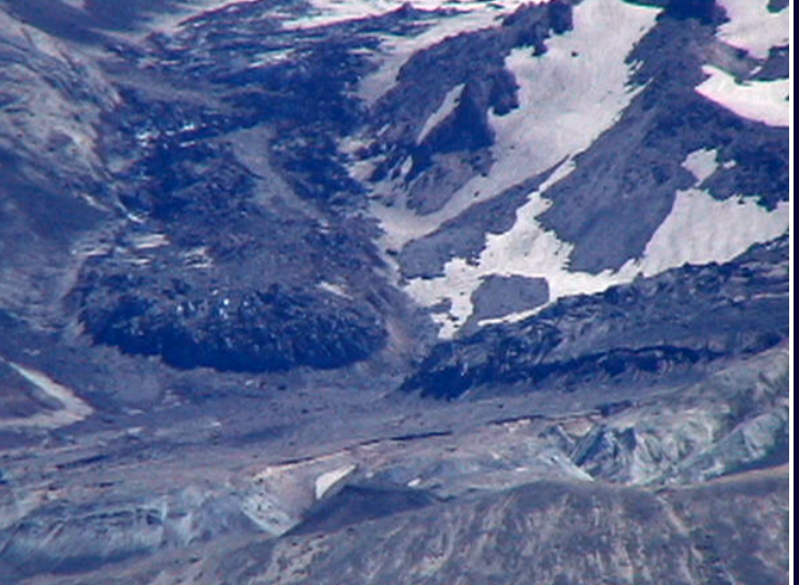
The tortured valley is picturesque in its own right.
Green can be seen clear up to the mouth of the crater… its pretty incredible!
A US Forest Service Ranger explains the explosion, and how what we’re seeing now came into being.
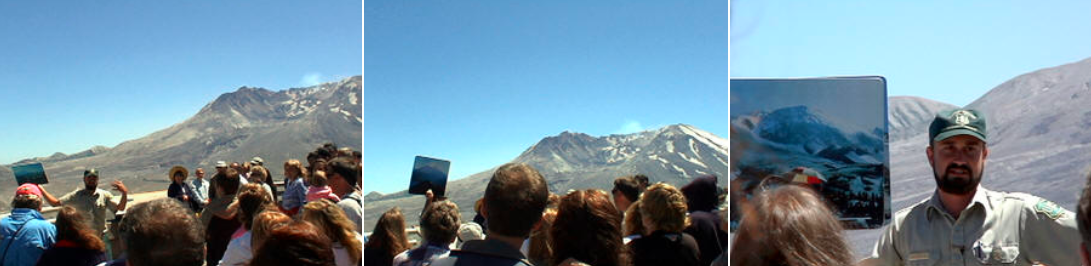
During the discussion, I noticed a landslide on the new dome… not a very big one, but it was still cool.
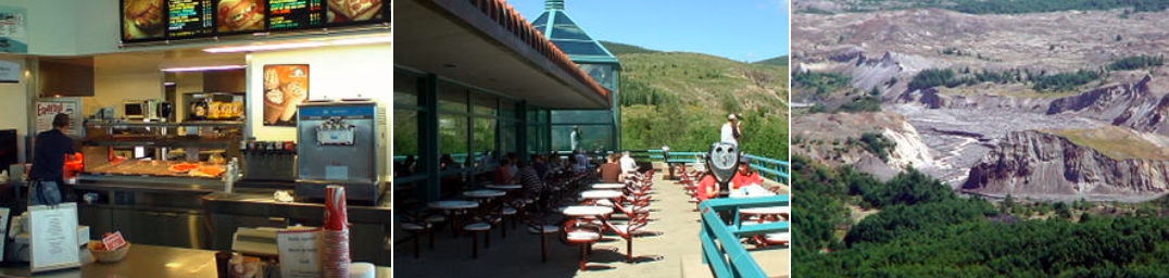
After listening to the Speil, we headed out in search of food, which is at the Cold Water Ridge Observatory.
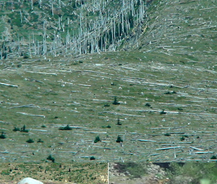
On the way to Cold Water Ridge, scenery that was behind you on the way up now comes into view… huge fields of trees still lay, baked white by the sun, where they were knocked over by the force of the blast, which happened about 10 miles from where these trees are…
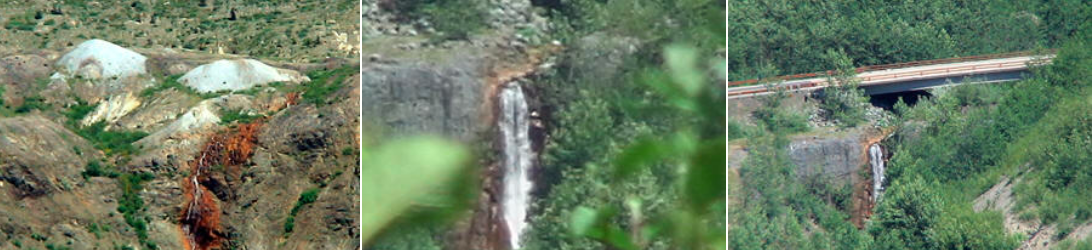
White mounds of Dacite rock bump some of the lower areas on the back side of Johnston Ridge, part of the debris from the explosion caused by the release of pressure.
A waterfall on Cold Water creek, once buried deep in an old growth forest, now falls in plain view.
Big Foot lived here in this valley, the legend went, making his home among the old trees. There hasn’t been a sighting near these parts since the blast.
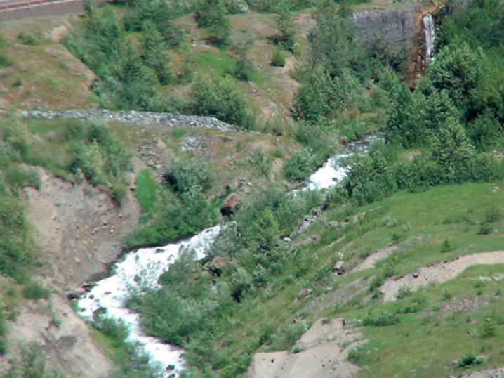
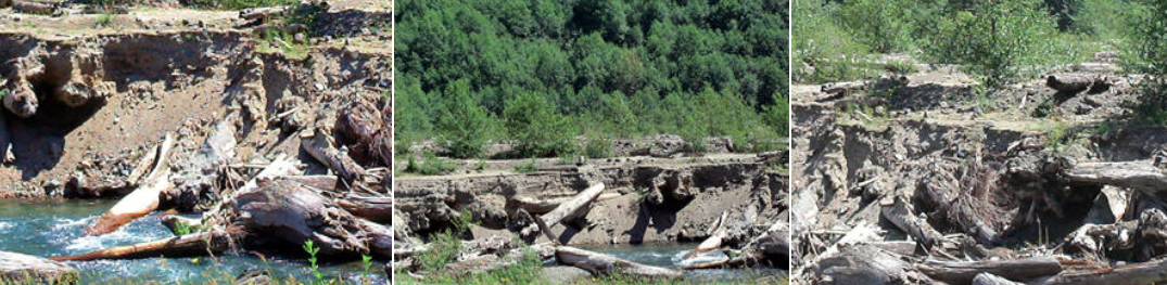
The creek, after cascading down the ridge, flows through its valley, cutting its way through several dozens of meters of debris left behind by the considerable portion of the landslide blown over the ridge by the huge blast.
Cold Water Ridge observatory, for a long time the closest you could get to The Mountain, sports a FANTASTIC view!
We grabbed pizza and a couple of “St Helens LAVA” burgers from the little eatery there, and enjoyed the view while we ate..
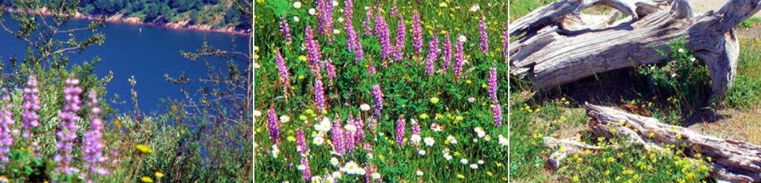
Cold Water Lake, formed by the 300-foot natural dam created by the landslide, came into being much the same way that Spirit Lake was formed. The Mountain shapes the land around it.
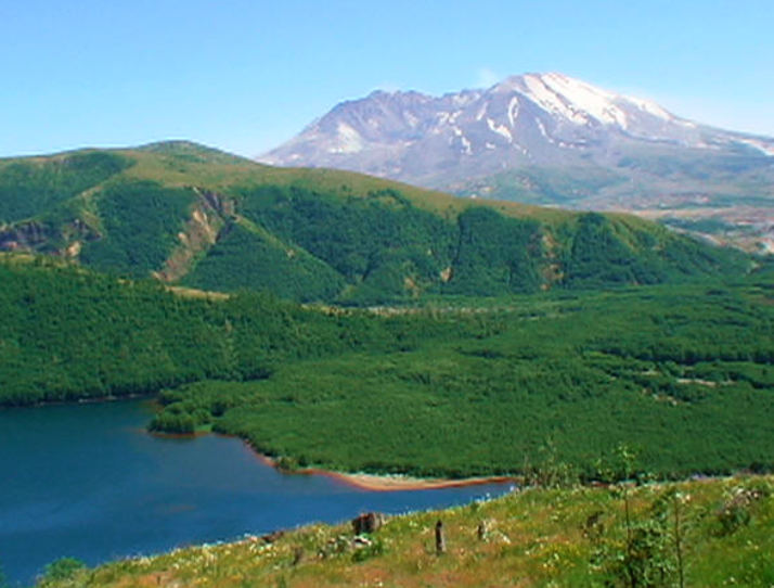
Without the blast, this picturesque lake would not exist.
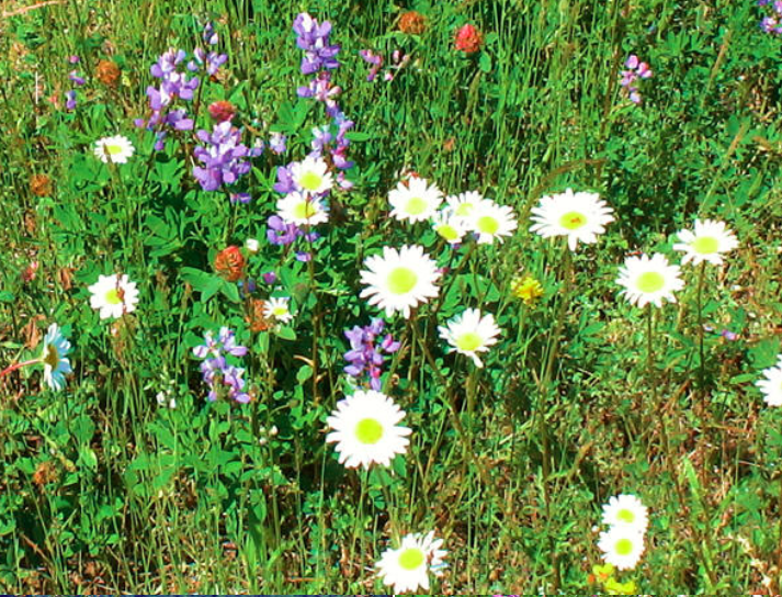
Flowers have established themselves here, too.
They made to a great end to a great day on the Mountain.
I’ll be back… probably sooner rather than later. 🙂